Florida State Parks
Florida Department of Environmental Protection

Main Menu

  • Plan your visit
    • Access for All
    • FAQs
    • Fees
    • Rules & Regulations
    • Camping & Lodging
  • Find a Park
  • Learn
  • Resources
  • Experiences & Amenities
    • Educational Opportunities
    • Programs
    • Research & Collecting
  • Get Involved
  • Events
  • Search
  • Camping & Lodging
  • Shop

Breadcrumb

  1. Home
  2. Find a Park
Palatka to St. Augustine State Trail

Palatka-to-St. Augustine State Trail

Multi-use trail runs through agricultural landscapes and scenic routes

Hours

8 a.m. until sundown, 365 days a year

Fees

No fee required

Location

State Road 207
Elkton FL 32033

Get directions

Contact Info

386-329-3721

Park Menu

  • Experiences & Amenities
  • History

Welcome to Palatka-to-St. Augustine State Trail

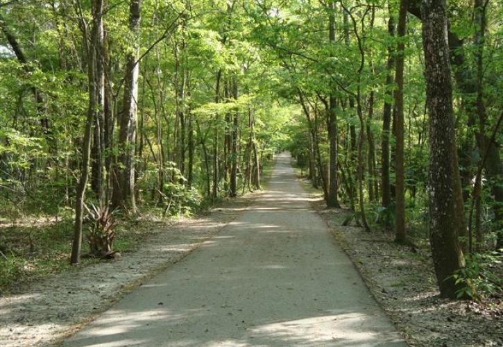
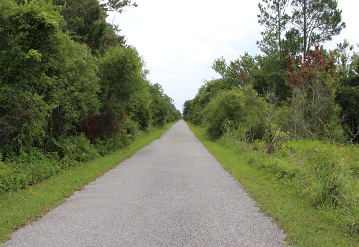
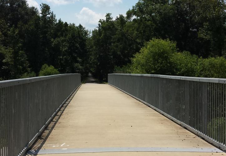
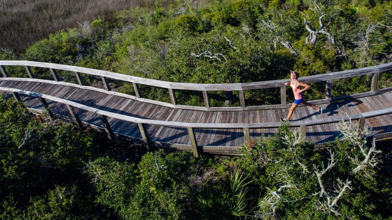
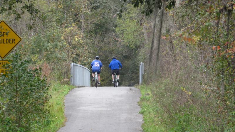
The Palatka-to-St. Augustine State Trail is a multi-use recreational trail along a corridor that stretches through St. Johns and Putnam counties.

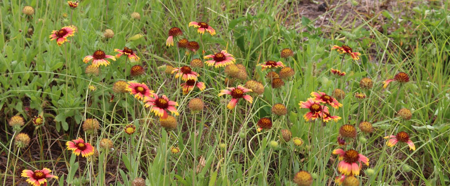
This 12-foot-wide, 19-mile-long paved trail runs through beautiful agricultural landscapes and scenic routes. You can begin your adventure from several access points. Starting in St. Johns County and traveling into Putnam County tends to be the popular route due to the ample parking at the eastern trailheads and the opportunity to visit the designated Florida Trail Town of Palatka mid-trip. 

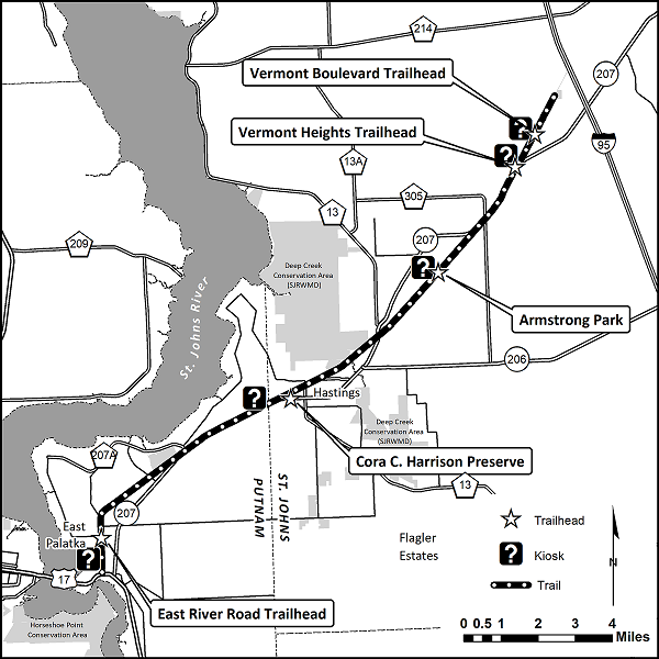
The trailheads below are listed from east to west:

Black and white map of the Palatka to St. Augustine State Trail
Palatka to St. Augustine State Trail Map

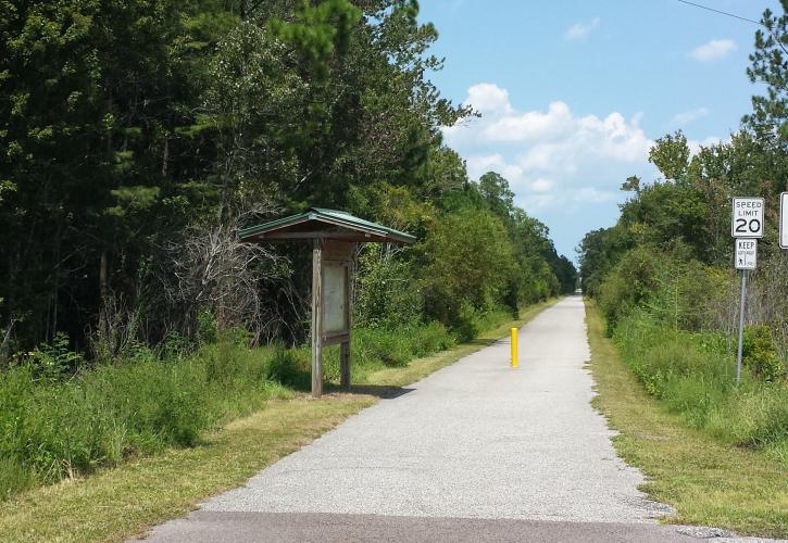
Vermont Blvd. Trailhead (GPS Lat/Long: 29.81569, -81.40269, St. Johns County): Located off Vermont Boulevard, this small trailhead includes a kiosk with a trail map and roadside parking only. This is the farthest east that you can access the trail, as the last mile runs east and dead ends at the railroad tracks. If you start at this trailhead and travel west the length of the trail, you will ride 35 miles round-trip.  

Vermont Heights Trailhead (GPS Lat/Long: 29.80313, -81.41137, St. Johns County): This trailhead is approximately one mile from the Vermont Boulevard Trailhead. Managed by St. Johns County Parks and Recreation, this location includes a kiosk with a trail map, parking, restroom and picnic area. If you start at this trailhead and travel west the length of the trail, you will travel 34 miles round-trip.  

Armstrong Park (GPS Lat/Long: 29.76242, -81.44736, St. Johns County): This trailhead, managed by St. Johns County Parks and Recreation, includes restrooms, parking, a picnic area and a playground. A kiosk with a trail map is located just west of the trailhead. This trailhead is 5 miles from the Vermont Boulevard Trailhead and 12 miles from the end of the trail in Putnam County.

Cora C. Harrison Preserve (GPS Lat/Long: 29.71619, -81.51528, St. Johns County): This trailhead, managed by St. Johns County Parks and Recreation, includes a restroom, parking and a picnic area. A kiosk with a trail map is located just west of the trailhead. This trailhead is 9 miles from the Vermont Boulevard Trailhead and 7 miles from the end of the trail in Putnam County.

East River Road Trailhead (GPS Lat/Long: 29.66153, -81.60081, Putnam County) This small trailhead located on East River Road includes three roadside parking spaces. A kiosk with a map is located just west of this parking area, marking the end of the Palatka-to-St. Augustine State Trail in Putnam County.

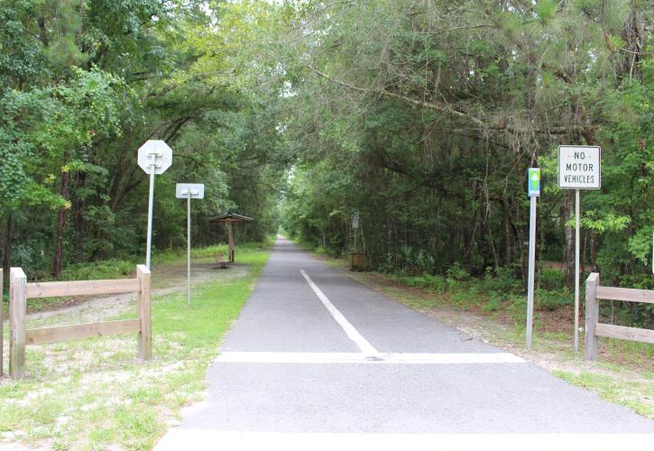
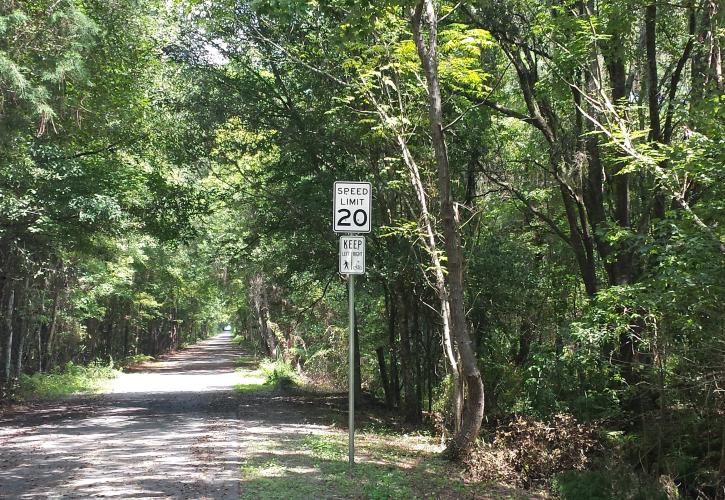
Please take caution at intersections, as it is the responsibility of trail users to stop (oncoming traffic does not have a stop sign). There are two sections of the trail that cross U.S. 207; please take caution and use the signals when crossing.

  • Please contact Ravine Gardens State Park at 386-329-3721 for more information or to report concerns.
  • For information about the St. Johns County trailheads, please contact St. Johns County Parks and Recreation at 904-209-0655.

Plan Your Visit

Katrina Boler
Learn

Manager's Message

The Palatka-to-St. Augustine State Trail runs through the communities of Vermont Heights, Elkton, Armstrong and East Palatka. Originally a Rails to Trails project, the trail runs along State Road 207.
Two people on bicycles ride along a paved trail surrounded by trees.
Learn

Cycling on the Palatka-to-St. Augustine State Trail

Enjoy the day exploring the small communities along this 19-mile multiuse trail or connect to a larger trail system and take an epic journey.
A round logo with writing and a picture of a palm tree in the center.
Learn

St. Johns River to Sea Loop

The Palatka-to-St. Augustine State Trail is a section of the St. Johns River to Sea Loop, a 260-mile multiuse trail that travels through five counties on the east coast of Florida.

Experiences

Bicycling
Bicycling
Hiking
Hiking

Amenities

Accessible Amenities
Interpretive Exhibit
Pets
Pets

Palatka-to-St. Augustine State Trail Photo Gallery

Palatka to St. Augustine
Palatka to St. Augustine Turtle
Palatka to St. Augustine
Palatka to St. Augustine Trail Bridge
Palatka to St. Augustine
A black and white picture of a church building.
Learn

Along the Trail - Community of Armstrong

Situated near the middle of the Palatka-to-St. Augustine State Trail is the small community of Armstrong, an area rich with African-American history.
Big Lagoon State Park Trail
Learn

Trails at Florida State Parks

Whether by bicycle, horse, wheelchair, kayak or on your own two feet, trails both within and outside our state parks can lead to a wide variety of adventure and opportunity throughout Florida.

People Make the Parks

Park Staff

Join the Team

Are you active, enthusiastic and enjoy serving others? Join the Florida State Parks team and help visitors experience Florida’s best loved places.
Three women stand on a paved trail next to a sign and a golf cart holding trash bags.

Volunteer Spotlight, Azalea City Brewing Company

Andrea Conover and her team at Azalea City Brewing Company have been busy keeping a 2-mile stretch of the trail free from litter.
Florida State Parks Foundation

Florida State Parks Foundation

The statewide nonprofit partner meeting critical funding needs for universal access, conservation, education and preservation.

Park Map

More Places You Might Like

See all parks
Man paddling in a kayak at Lake Griffin

Lake Griffin State Park

Camp, hike, fish and explore where wildlife thrives and a 400-year-old live oak stands proud.

3089 U.S. Highway 441-27
Fruitland Park FL 34731

Fairchild Oak at Bulow Creek

Bulow Creek State Park

Bulow Creek protects nearly 5,600 acres, more than 1,500 of which are submerged lands. The reigning tree of the park is the Fairchild Oak, one of the largest live oak trees in the South.

3351 Old Dixie Highway
Ormond Beach FL 32174

View of fishing pier at Sebastian Inlet State Park

Sebastian Inlet State Park

Whether riding the waves, strolling the shores or fishing from the jetties, beach lovers will find their paradise at Sebastian Inlet State Park. Calmer waters on the Indian River Lagoon beckon kayakers to explore wild beauty.

9700 South Highway A1A
Melbourne Beach FL 32951

Florida State Parks

Main Menu

  • Plan your visit
    • Access for All
    • FAQs
    • Fees
    • Rules & Regulations
    • Camping & Lodging
  • Find a Park
  • Learn
  • Resources
  • Experiences & Amenities
    • Educational Opportunities
    • Programs
    • Research & Collecting
  • Get Involved
  • Events

Have Questions?

Contact the Statewide Information Line:

(850) 245-2157

Or send an email to:

FSP.Feedback@FloridaDEP.gov

Stay Connected

  • Facebook
  • Twitter
  • Instagram
  • Pinterest
  • You Tube
© Copyright 2025 © Copyright 2018 Florida Department of Environmental Protection.
  • Customer Survey
  • Disclaimer
  • Privacy Policy
  • Website Login